Pechey Forest is a managed forest south of Crows Nest that was established over 100 years ago to see which non-native trees would provide good wood for the Toowoomba market. It was a weekday, and I was keen for a ride that did not have a stretch on the New England Highway. On the plus side, it has well-graded roads and shade for most of the day. The downside is the repetitive nature of the scenery.
Select an image for a larger view. Maps are linked to dynamic originals.
Getting There

After driving south on the New England Highway from Crows Nest, I turned left and parked on Millard Road. It is the most northerly east/west road inside the forestry reserve. Longer rides are best from the eastern side of the forest, where there is more land to get lost in. I chose this side because of the old fire watch tower, as discussed on the Mountain Bike Mecca page.
The Access Road

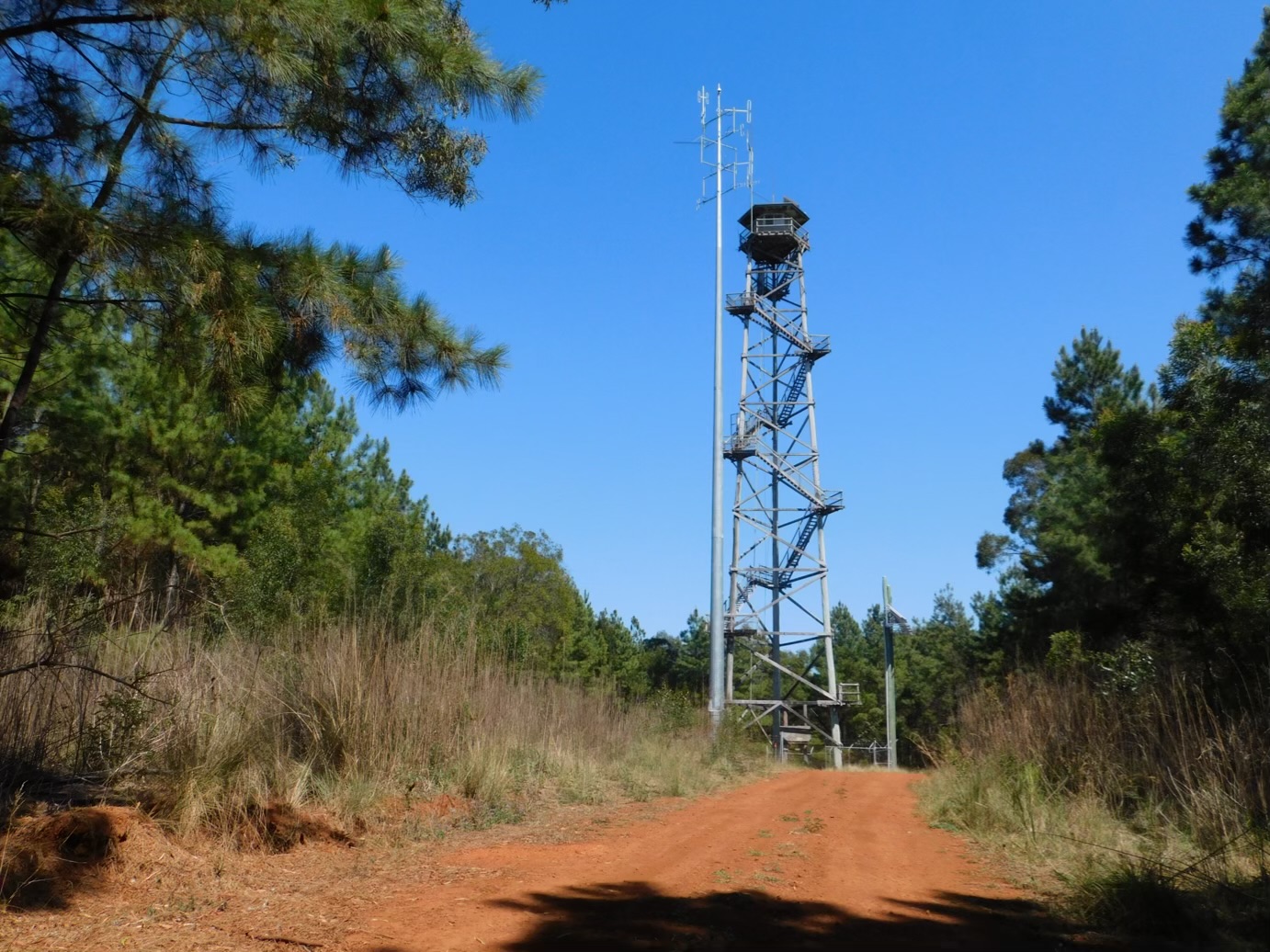
The access road runs parallel to the New England Highway until we reach the first of the grid roads—the one that passes the fire watch tower. Interestingly, the roads are made of a different material—more dusty. It is hard to imagine that different groups would build and maintain them.
A Grid Road

This grid road, as straight as something straight, arrows off a few degrees west of south. As the highway goes southeast, we soon enter a region of relative silence. I am sure an arborist would disagree, but it makes for a smooth but boring ride for me. Definitely a ride for riding’s sake, not a ride to enjoy the view. Not my cup of tea. Notice the shade across the road. For most of the day, you will be protected from sunburn.
Paths to Nowhere

Not all roads are grid roads. Given that these paths are narrower and overgrown, they served a purpose in the past. I chose not to ride down one – more due to laziness than any good reason. Note that the narrow nature of these paths makes them less visible from an aerial view.
Into the Distance

The Google map shows that service roads are straight and at right angles. Still, seeing shows the magnitude of the feat. The roads are not necessarily flat. This photo is on the top of a mild rise. Mind you, Toowoomba has north-south (Hume) and east-west (Jellico) streets that are straight for the length or breadth of the city.
Finding the Watchtowers

The following narrow path is better maintained as it leads to a pair of facilities to monitor for files. If I hadn’t looked closely, I might have missed them altogether. In hindsight, the quality of the track and the two metal posts were a dead giveaway. I did ride up this track.
Then and Now

This forestry project was initiated in the 1920s. I am not sure when the staffed tower was built; it could have been pre-war. The replacement tower is from this century, as it runs off solar power, batteries, and remote control.
Steps from Nowhere

The first two flights of steps have been removed to discourage fence jumpers. I don’t think that would be enough of a deterrent for a seasoned climber. I wouldn’t trust the integrity of the rest of the steps of the building on top. Then again, I have height issues from the roof of my single-story house, no matter this tall and spindly structure.
Out of the Forest

This grid road leads back to a local unpaved road that I ride back to my car. While lightly trafficked, it is wise to look at cars and take precautions. I cover my glasses as they pass, just in case an unfriendly stone comes my way.
Yucca

Apple Photos says that this is a Yucca, a plant native to the Americas. I am not sure what it is doing here. It is part of the asparagus family—who would have guessed?
I am sorry that this is one of my more uninteresting posts. If my passion were trees rather recumbent trikes perhaps I could have done a better job.